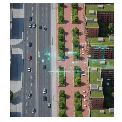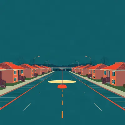
Five thousand seven hundred and eighty-three miles of streetcar track in eighteen ninety. Seventeen years later, thirty-four thousand. American cities built a continent of tram-wired neighbourhoods in less than a generation, and then tore most of the rails out again.

And the strange part is what was left behind kept working.
That's the setup for today. Hannah sent this one, which is a nice change of pace from the usual desk. She's been chewing on the term "streetcar suburb" — the thing we bumped into when we talked about Australian housing looking like the American South — and her point is that the label has gone stale. These places read as suburban next to a nineteenth-century downtown, but next to a modern car suburb they're compact, walkable, stitched to transit, with shops mixed in. Her question is where this form actually sits in the search for the ideal way to house people. Is it one of the better models we've come up with? It gives you a detached or semi-detached house and a garden without giving up walkability — she calls it, roughly, the North American and Australian cousin of the British townhouse neighbourhood.
Which is a good cousin to have. The townhouse band and the streetcar band turn out to be surprisingly close in numbers.
She also wants the hierarchy tested. If you were designing a city in layers, apartments in the core, could the streetcar neighbourhood be the natural next ring out? How dense does it have to be to carry frequent transit and cafés and schools? And then the big one: Nir Buras's idea that a city should stop at a hard edge instead of dissolving into sprawl — could a streetcar ring be the last urban neighbourhood before the farmland starts, rather than the thin end of the wedge?
And the last part of her question is the engineer's part: what would you change about the historical model to make it work today? That's the part I keep rewriting in my head.
Before we argue about where it belongs, let's be precise about what it actually was. Definitions first.
So the textbook definition: a residential community whose growth was shaped by streetcar lines as the primary means of getting around, built in that window before the car let the middle class move beyond the central city. Richmond, Virginia got the first successful electric system in eighteen eighty-seven, Frank Sprague's, and the track mileage just exploded — that five thousand seven hundred to thirty-four thousand jump we opened with. Most of that was feeder lines to new housing.
The mechanism is worth slowing down on, because it's simpler than people expect. The trolley moved you in ten minutes what you'd walk in thirty.
That's it. That's the whole trick. It roughly tripled the walkable radius of the city. Anything within a ten-minute walk of a stop was now within commuting distance of downtown, so developers could sell farmland as housing lots, and the street themselves — the streetcar companies were often in the land business, selling electricity to the developments and fares to the riders. Some lines existed mainly to open land.
The transit company as the developer. Very tidy vertical integration.
And the physical form followed directly. Gridiron street plans, lots no wider than thirty to forty feet, prominent front porches, and driveways rare — built-in garages almost nonexistent, because the street was for people and the tram and nobody expected to store a tonne of machinery beside the house. The classic styles are the California Bungalow and the American Foursquare, and a lot of them were literally bought out of a catalogue. You picked the design, the materials arrived by railcar, and a local crew assembled it.
Housing by mail order. I'd like to see the return policy.
One structural thing that matters for Hannah's question: streetcar suburbs formed continuous corridors stretching out from the core, on the grid plan of the older city. Railroad suburbs — the older type, built around steam stations — formed in pockets, little nodes around each station with countryside between. The streetcar version was a finger of urban fabric extending outward, with homes within a five to ten minute walk of the line.
Hold that geometry in mind, because it comes back to bite later. The corridor shape is exactly why the form could be extended indefinitely once the car showed up.
And the tension I'd frame the whole episode around: these places were built dense and walkable, they lost the rails decades ago in most cities, and they still function. Which suggests the durable asset was never the tram — it was the fabric. The block sizes, the lot widths, the porches facing the street, the corner shops. The tram was the excuse; the neighbourhood was the product.
So the form was built dense and walkable, the question is how dense, actually, because the numbers are messier than you'd expect. Hannah asked for a number. There isn't one clean number.
There really isn't. Published figures for streetcar suburbs range from about four to nineteen units per acre, and the spread isn't sloppiness — it's measurement. Gross or net makes a huge difference. If you count just the residential land, you get a much bigger figure than if you include streets, parks, school grounds, and commercial blocks the way a census tract does. And then there's the question of unit of analysis: one block, one tract, or the whole municipality, which drags in whatever else the town happens to contain.
So give her the band rather than the number.
Roughly seven to fifteen gross dwelling units per acre for the classic form. The University of British Columbia's planning school puts the classic streetcar cities — Seattle, Minneapolis, Dayton, Los Angeles, Edmonton, Vancouver — at seven to fourteen units per gross acre, with most homes within a quarter mile of a stop. At the top end, Oak Park, Illinois, mostly built between the eighteen nineties and the thirties, runs nineteen dwellings per acre in one census tract, and it supports a proper two to three storey downtown. And for contrast, a modern auto-oriented suburb sits around four.
Four versus ten-ish, call it. A two to three times difference between things that share a name.
Same word, different continent. Now the interesting move is to test that band against the service thresholds, because planning bodies have actually published what density transit needs. Puget Sound Regional Council says residential densities above seven or eight homes per gross acre support efficient and reliable local transit. Richmond, Virginia has a whole ladder: seven dwellings per acre for basic bus service, fifteen for frequent local bus, nine for light rail, twelve for rapid transit. Minnesota's GreenStep programme says the same thing in service terms — seven to eight units per acre supports an hourly bus, fifteen supports a ten-minute headway.
The streetcar neighbourhood at seven to fourteen lands right on top of the frequent-bus band.
That's the payoff. The historical streetcar suburb sits precisely in the density band that supports frequent local bus and light rail. Nobody wrote that guidance in nineteen ten — the neighbourhoods predate the thresholds by decades — and yet they land on them. It's not an accident that they're transit-supportive. The five to ten minute walk to the stop, the narrow lots, the continuous corridor: that combination produces exactly the ridership geography the modern thresholds describe. The form was the threshold before the threshold existed.
Which is a suspicious amount of virtue for a real estate scheme.
The streetcar companies wanted riders, and riders need houses within walking distance, so the incentive did the zoning for them. Now, honest complication, because Hannah also asked about shops, cafés and schools, and there the answer is less clean. No source I know of quantifies a separate threshold for local services — the transit density is the best available proxy, on the theory that a block that supports a ten-minute bus supports the bakery that bus riders pass. But Richmond's own plan notes employment densities have a greater influence on trip-making than residential densities do, which means the shop question depends partly on where jobs sit, not just how many homes are around them.
So "how dense for a good high street" is open. Anyone who gives Hannah a confident number on that is selling something.
Right — the transit ladder is measurable, the café threshold is folklore with good instincts.
Set up the comparison, then, because she asked where it sits against the alternatives. I'd do it as a ladder rather than a list.
Going up the density ladder: at the bottom, the conventional detached car suburb at about four units per acre, which cannot support frequent transit at all — it's below every threshold on the Richmond ladder, which is why those places are car-dependent by arithmetic, not by culture. Just above it, the garden suburb — Howard's idea — drops below the transit threshold on purpose and leans on the car. Then the streetcar neighbourhood, seven to fifteen, detached and semi-detached houses with real gardens, clearing the frequent-bus line. Above that, row-house neighbourhoods push higher and give up the private garden for a party wall. Courtyard blocks trade street frontage for internal open space and go higher still.
The streetcar form is the only rung on that ladder that hands you a house with a garden and keeps you above the transit line. Everything below it needs a car, everything above it takes your lawn.
That's the specific combination, and it's why Hannah's instinct about the British townhouse is right. The townhouse neighbourhood is the same density band, the same walkability, the same relationship to a high street — but the North American and Australian version gives you a gap between houses instead of a shared wall, and a garden you can actually swing something in. It's the same product pitched to a slightly less compressed culture.
The streetcar suburb is the townhouse with a buffer zone.
I once spent a whole episode walking people through the beginner's urbanist toolkit — Jeff Speck, walkability first principles — and the thing I'd tell that listener now is that this is the exact housing type all that vocabulary was circling around without naming. The streetcar suburb is the answer to "walkable, but I still want a yard."

Friends, are you tired of your neighborhood slowly fading into sprawl? Then you need Streetcar Suburb In A Box, the monthly subscription that delivers a fresh, walkable streetcar suburb right to your door, every single month, for just forty nine ninety nine.
Choose from three tiers: Bronze gives you a charming bungalow and a quarter mile of sidewalk, Silver adds a corner café and a streetcar that runs every ten minutes, and Platinum includes a hard urban edge so your city simply stops and the countryside begins. Cancel anytime, though our cancellation policy requires a notarized letter, a blood sample, and a forty percent restocking fee, because we know you will never want to leave.
Herman. That was your voice doing the warm-up this morning. The bungalow cadence was yours.
It was not my cadence. I warm up with the Richmond density ladder, as you well know, because the numbers carry the voice. Four thresholds, no adjectives. Nobody who has heard me read a bus-service threshold would mistake that for me. Also I would never price a streetcar suburb under fifty dollars, and I resent the implication that I'd round down.
Mm. The denial had a lot of furniture in it.
The denial was proportionate. Back to the ladder. Where were we — the garden, the party wall.
The gap between houses. Which is what you're buying at that rung, the transition band.
So it clears the transit threshold and beats the alternatives on garden-plus-walkability. The harder question is what happens at the edge of the city, and this is where I want to sharpen the term critique, because "streetcar suburb" is doing double damage as a phrase.
Two words, both wrong.
Both wrong, in opposite directions. "Suburb" undersells the density — seven to fifteen units per acre is two to four times a car suburb, and it clears every frequent-transit threshold. But "streetcar" oversells the transit, because most of these places lost their trams decades ago and still work. UBC's formulation is the cleanest I know: the streetcar city principle is not about the streetcar itself, it's about the system the streetcar was part of — the relationship between land use, walking and transport. The streetcar built the geometry; the geometry outlived it. Patronage peaked in nineteen twenty-three at fifteen point seven billion rides a year and declined every single year after. The rails went, the buses replaced them on the same corridors, and the neighbourhoods carried on being neighbourhoods.
The tram was scaffolding. You take the scaffolding off and the building stands.
Then the uncomfortable historical point, because we've been talking about these places as if they were mixed-use by nature. They weren't. The shops were confined to specific streets — the strips along the heavier routes and the intersections — and that separation is literally the beginning of residential and commercial zoning in cities. The mixed-use main street we now praise them for was the exception, a concession along one or two frontages out of a whole district. A modern version would have to re-mix more aggressively than the nineteen ten original did, or you rebuild the very separation that hardened into single-use zoning.
So the form invented the disease it's now celebrated for having survived. Its immune system is a preserved symptom.
That's the irony, yes. And the deeper irony is the geometry one I flagged earlier, and this is where Buras comes in, because Hannah's hard-edge question cuts right against the form's history. Streetcar suburbs grew as continuous corridors along radial lines — no endpoint, no boundary, just a grid extending along the track. The moment the streetcar died and the car arrived, that geometry made extension trivial. You didn't need a new tram line to justify the next addition; a road would do, then just a road on a map. The form that produced walkable density also handed sprawl its template. Every American sunbelt city that dissolved into the countryside did it along streetcar-suburb fingers first.
The corridor was a feed line in both directions. It fed the core, then it fed outward.
So whether a modern version can be capped at a boundary is the interesting design question, and it's the exact friction with Buras. Quick sketch of him for the listener: Nir Buras, Israeli-American architect, trained as a military planner, worked at the big American firms, lead designer on the East Side Access work at Grand Central. He founded the Classic Planning Institute in Washington, and his book, The Art of Classic Planning, came out from Harvard University Press in early twenty twenty. His principles include "respect the magic of a place, and balance town and country."
And the balancing act is exactly where his own writing goes quiet, isn't it.
It is, and I want to be straight about the limit: I can't point you to Buras's own prescription for the urban edge in his words. The principle is "balance town and country," and one reviewer, Patrick Webb, summarised his history as planners abandoning the city for gardened enclaves — "an escape that was short lived, as the suburban frontier soon became overrun by sprawl." That's the diagnosis, and it fits the streetcar story almost too well. But the actual chapter on designing a city sits behind a paywall, and I'd rather say that plainly than invent a Buras doctrine of the boundary.
Noted. So we do the work ourselves: can the corridor be capped?
I think yes, and the reason is that the corridor's endlessness was a property of the land speculation, not the architecture. The block, the lot width, the porch, the corner shop — none of that requires continuation. A streetcar-style neighbourhood that terminates at a green belt instead of tapering into quarter-acre lots loses nothing in the fabric. What it loses is the option value of the farmland at the edge, which is exactly the value sprawl runs on. The hard edge isn't a design problem so much as a political one — someone has to tell the landowners at the boundary no, permanently, and every city that couldn't do that got Dallas.
You say "the boundary" as if it's one decision. It's one decision re-made every planning cycle for a century.
Which is why I'd trust a wall more than a policy. Edinburgh manages it with a green belt that keeps getting nibbled; Paris managed it with boulevards and then failed at it with the banlieues. The edge holds where the culture agrees the countryside is a good in itself — England's is sentimental about hedgerows, and Buras's argument is essentially that you can build that sentiment deliberately rather than inherit it.
So answer Hannah's hierarchy directly. Core, then what?
Apartments and mixed-use in the centre, then the streetcar-style neighbourhood as the next ring for people who want their own house and garden but still want to walk to the shops and the stop — and the density band is what makes the ring work, because seven to fifteen at the outer edge is exactly what keeps transit and services viable at the far end of the line. That's the specific thing sprawl can't do. Then the hard edge, then countryside. The streetcar neighbourhood is the last urban layer, the low note the city ends on.
The coda. Now the market evidence, because the revival isn't hypothetical — Portland actually rebuilt one.
Portland's modern streetcar, between ninety seven and two thousand five, drew two point two eight billion dollars of investment within two blocks of the alignment, over seven thousand two hundred residential units, four point six million square feet of commercial space. Fifty-five percent of all new development in that window landed within one block of the line. And developers built at ninety percent of allowable density on the alignment — twice the rate of areas three or more blocks away. The demand was so strong it was visible in how much of the zoning developers actually used, which is about as unambiguous as real estate gets.
Ninety percent of allowed density. The zoning was the constraint, not the market.
And there's a built-from-scratch version: Orenco Station outside Hillsboro, Oregon. Eighteen hundred homes, a town centre, offices and retail on two hundred and nine acres — about eight point six homes per acre, right in the historical band, with a grid of tree-lined streets, cottages, rowhomes, condominiums. It's the streetcar suburb reassembled from parts.
Though calling it a streetcar suburb when it's a light-rail suburb is doing the same word crime we started with.
The descendants never fix the naming. On value, the New Urbanism Lexicon says these places are "usually the most valuable real estate" — the historical ones, that is, per acre, in city after city. Though the honest counterweight: the two thousand five comparison, housing thirty percent cheaper and transport seventy-five percent cheaper than car suburbs, is two decades stale. It predates the entire current housing crunch, and given that these neighbourhoods are now the most sought-after fabric in most cities, my guess is the affordability advantage has inverted. The form is cheap to run and expensive to buy.
The running costs were always the quiet half of that deal. Seventy-five percent off transport is a raise nobody notices.
Right, so to the last piece of Hannah's question — what would we change about the historical model? Three things, and I'll commit to them. First, re-mix the main street: don't confine commerce to one strip, thread it through, put shops at more intersections, apartments over more of it, because the nineteen ten version separated uses and we spent a century paying for that. Second, design the corridor to terminate. Decide where the last block is while you're drawing the first one — put something at the end that wants to be an end: a station square, a market, a park wall, so the edge is a place rather than a fade. Third, treat the walkable fabric as the asset and the transit technology as swappable. Rails, buses, whatever comes next — the constant is the five-minute walk and the block that earns its corner shop.
I'd add a fourth, from the sloth's perspective: keep the porches. Everything that happens on a porch is the neighbourhood watching itself.
Noted and entered into the record. The streetcar neighbourhood delivers the house and the garden on the one rung of the ladder where the transit still pencils — I don't actually know what we'd change about the porch.

The fabric is the asset, agreed.
I had a book house on a thirty-four foot lot. Foursquare, porch across the front, no driveway. The catalogue page is still in my filing cabinet — the ones with the kit homes, you order the house out of the book, materials come by railcar, two boxcars for the Foursquare, and the page prints the lot width the design is meant for. Thirty-six feet. My lot was thirty-four. I measured it twice with a cloth tape, the metal ones don't sit right on a claw.
Thirty-six in the catalogue.
Thirty-six. The house next door was redeveloped four years ago by a man who put the driveway cut through what the catalogue calls the side yard, which took half the back garden, and I wrote him a letter about it. He didn't answer. Since then I keep a list, on paper, of every house on that block whose lot width no longer matches its catalogue page — which were widened, which were cut. Eleven houses. Nine widened, two subdivided. Had the list laminated after the coffee incident, that was a mistake.
You sold the house.
Sold it in the spring. The list stays with me. Corn, you spent most of this hour defending the fabric and ten minutes defending the porch, and the porch is the only part of the house that man didn't touch, so there's your comfort.
Eleven of twelve accounted for. What's the twelfth?
My own. Thirty-four where the book says thirty-six. That one I left blank on purpose. It's not a mismatch, it's a margin.
A margin of two feet. That's exactly the kind of specification nobody prints anymore — the lot width printed on the order form. That's the whole design argument in one document: they weren't laying out neighbourhoods by feel, the kit had a lot.
They had one number for the lot and one for the boxcars. That's more precision than the council showed. I did two years estimating for a mill outfit in my thirties, nobody there matched a catalogue either.
The cloth tape. That's the detail I'd keep — a man with a filing cabinet, a laminated list, and a grudge against one driveway.
The open piece is the edge. The streetcar neighbourhood clears the transit threshold and hands you a garden, but its geometry is the same geometry that made sprawl easy — the corridor that extends, the fade instead of the stop. Whether a modern version can be capped is unresolved, and Buras's own prescription for that edge, in his words, is something we couldn't confirm. The principle is "balance town and country"; the drawing is behind the paywall.
The other open one is the density question Hannah asked straight out, and the honest answer is nobody has published a threshold for shops and cafés and schools separate from the transit threshold. The bus ladder is measured; the high street is folklore. And employment density may matter more than residential anyway, which turns the whole question partly into a question about where the jobs sit.
Though the market has voted on the fabric. Most valuable real estate, city after city, the Portland numbers, ninety percent of allowable density. Whatever else is true, these places age better than almost anything we've built since.
Thanks to Hilbert Flumingtop for producing, as ever. If you want more of this, try episode five oh four, How to Start Thinking Like an Urbanist; episode sixty-four eighty-eight, Why Australian Suburbs Resemble American Ones; and episode twenty, Architectural AI. This has been My Weird Prompts — if you've enjoyed this one, a review on Spotify helps more than a laminated list. We'll be back soon.



 chatterbox-regular