Hey everyone, welcome back to another episode of My Weird Prompts. We are coming to you from our usual spot here in Jerusalem. It is a beautiful afternoon, though if you look toward the north, you can almost feel the weight of the geography we are going to talk about today. I am Corn, and I am joined as always by my brother.

Herman Poppleberry, at your service. It is good to be back at the table. You know, Corn, normally we are reacting to something our housemate Daniel sent over in a voice note, but today we decided to take the reins ourselves. Daniel is actually out of the house today, so we thought we would dive into a topic that has been sitting on our research pile for a while. It is something that sits right on our doorstep, relatively speaking, but feels like it belongs to another world entirely. We are talking about the strange, high-stakes geography of the northern border. Specifically, the Shebaa Farms and the village of Ghajar.
It is that concept of sovereignty by geography, right? Where the literal dirt and the specific coordinates of a fence line matter more than almost anything else. We often think of borders as these solid, immutable things, but in the north, they are more like living organisms. They shift, they breathe, and sometimes they are completely invisible until someone steps over them. So, Herman, let's start with the basics for those who might only know these names from news headlines. What exactly are the Shebaa Farms, and why are we still talking about them decades after the major wars ended?
To understand the Shebaa Farms, you have to understand that it is essentially a twenty-two square kilometer strip of rugged, mountainous terrain. It sits right at the intersection where Lebanon, Syria, and Israel meet on the slopes of Mount Hermon, or Jabal al-Sheikh as it is known locally. Now, the reason it is so contentious is because of a very messy colonial history and some very deliberate modern ambiguity. Historically, under the French Mandate in the early twentieth century, specifically the nineteen twenties, the border between Lebanon and Syria was never clearly demarcated in this specific area. The French were in charge of both territories, so they did not see a pressing need to draw a hard line through a bunch of rocky grazing land.
And that lack of a line is the original sin of this entire dispute. When Israel captured the Golan Heights from Syria in the nineteen sixty-seven Six-Day War, they took the Shebaa Farms as part of that Syrian territory. For decades, the international community, including the United Nations, treated it as Syrian land occupied by Israel. But then we hit the year two thousand, and the entire narrative shifted.
In May of the year two thousand, Israel withdrew its forces from Southern Lebanon, ending an eighteen-year presence there. The United Nations stepped in to verify that withdrawal, creating what we now call the Blue Line. This is a critical distinction for our listeners to understand. The Blue Line is not an internationally recognized border. It is a withdrawal line. It was drawn by the United Nations specifically to confirm that the Israel Defense Forces had left every inch of Lebanese territory based on the best available maps from the nineteen twenties.
And this is where the cartographic gymnastics begin. Because when the United Nations drew that line, they looked at all the old maps and the historical data, and they concluded that the Shebaa Farms were actually Syrian, not Lebanese. Therefore, Israel did not have to withdraw from them to satisfy the requirements of leaving Lebanon. But as soon as the withdrawal was complete, Hezbollah and the Lebanese government claimed the United Nations was wrong. They said the Shebaa Farms were actually Lebanese land that had been wrongly classified as Syrian for seventy years.
It was a brilliant strategic move, if you look at it from a purely tactical perspective. By claiming the Shebaa Farms were Lebanese, Hezbollah could argue that the Israeli occupation of Lebanon had not actually ended. This gave them the legal and political cover to maintain their armed status and continue their resistance operations. And here is the kicker, Corn. Syria, which technically owns the land if you follow the old maps, verbally supported the Lebanese claim. But they refused to provide the United Nations with any signed documents or official maps that would prove it.
It is the ultimate "he-said, she-said" of international law. Syria gets to keep its claim alive through a proxy, Lebanon gets to claim its territory is still occupied, and Hezbollah gets a permanent reason to exist as a military force. It is a perfect stalemate. Even though Israel left the rest of Southern Lebanon, the existence of this one tiny strip of land allows the cycle of conflict to continue indefinitely.
It really highlights the danger of these frozen borders. When you leave a line undefined, you are essentially inviting someone to come along and test it. But I want to move us a few kilometers to the west, because there is another place that is even more bizarre in its daily reality. That is the village of Ghajar.
Ghajar is one of the most unique places I have ever studied. It is an Alawite village, which already makes it an outlier in the region. Most of the surrounding villages are either Druze, Maronite Christian, or Shiite Muslim. The residents of Ghajar are Alawites, ethnically and religiously connected to the ruling elite in Syria. Historically, the village was entirely within the Syrian Golan Heights. But as the village grew over the decades, especially after Israel took the Golan in nineteen sixty-seven, it expanded northward. It basically spilled over an invisible line into what was technically Lebanese territory.
Right. So, when the year two thousand came around and the United Nations drew that Blue Line we were talking about, they literally ran the line right through the middle of the village. The northern half of the village was now technically in Lebanon, and the southern half was in the Israeli-controlled Golan Heights. This created a situation that sounds like something out of a surrealist novel. For years after the withdrawal in two thousand, the village was essentially an open door. There was no physical fence or wall running through the middle of the town.
Can you imagine the daily life there? You have a village where the northern side is Lebanon and the southern side is Israel, but the people living there are all the same families, they all have Israeli citizenship, and they are all moving freely between the two halves. It was a security nightmare for the Israel Defense Forces. If the northern half of the village is open to Lebanon, that means anyone from Lebanon can walk into the northern part of Ghajar. And since there is no fence inside the village, they could technically walk right into the southern half and then into the rest of Israel.
It was not just a theoretical nightmare; it was a practical one. In the early two thousands, Ghajar became a major hub for smuggling. We are talking about drugs, weapons, and intelligence. But even more seriously, it was a point of contact. There were documented cases of Hezbollah cells making contact with residents or using the village to monitor Israeli troop movements. The most famous incident, or perhaps the most infamous, was in November of the year two thousand five. Hezbollah launched a massive, coordinated raid on the village. They used motorcycles and paragliders to try and kidnap Israeli soldiers. It was a brutal firefight right in the streets where children play.
That really changed the calculus, did it not? You cannot have a sovereign border that is just a street in a village where a militia can drive through on a motorbike. But the diplomatic problem was that Israel could not easily build a fence through the middle of the village because it would split families apart and create a humanitarian crisis. And they could not build a fence around the northern perimeter because the United Nations said that was Lebanese land. So for years, the village sat in this weird limbo. The residents were essentially living in a closed military zone. If you were an Israeli citizen from Tel Aviv, you could not just drive into Ghajar. You had to have a special permit or a reason to be there. It was a village under a bell jar.
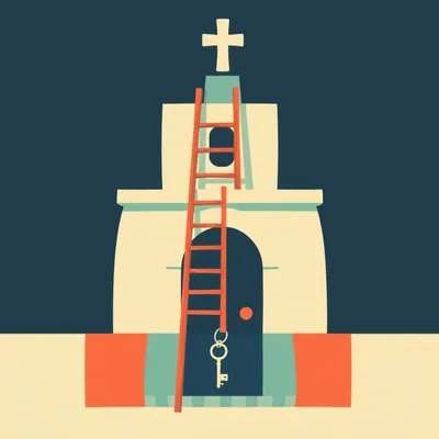
It is a perfect example of what we discussed in episode five hundred forty-four about engineering sovereignty. Sometimes the physical infrastructure is the only thing that creates the political reality. For nearly two decades, the residents of Ghajar were caught in this trap. They were technically Israeli citizens, they paid Israeli taxes, they used the Israeli healthcare system, but they were physically cut off from the rest of the country by a security checkpoint, and their village was partially occupied by a foreign power according to the United Nations.
It was a very difficult life for them. Imagine being a teenager in Ghajar and wanting to go to a movie in Kiryat Shmona, the nearest big Israeli town. You had to go through a military checkpoint every single time. And on the other side, you had the constant threat of being caught in a crossfire between Hezbollah and the Israel Defense Forces. But things have changed quite dramatically in the last few years. There was a major shift around twenty-two and twenty-three.
Yes, and this is the part of the story that most people outside of Israel do not know. Israel eventually decided to build a security fence around the northern perimeter of the village. Basically, they enclosed the entire village within the Israeli security perimeter. From a tactical standpoint, they effectively annexed the northern half of the village to the southern half and protected it from the Lebanese side with a serious physical barrier.
And what was the reaction from the international community? Because technically, that fence is on Lebanese soil according to the Blue Line.
Oh, there were protests. Lebanon filed complaints with the United Nations. Hezbollah used it as another item on their list of grievances. But for the residents of Ghajar, the impact was the opposite of what you might expect. Instead of feeling more isolated, they felt liberated. Once that northern fence was secure, the Israeli military was able to remove the checkpoint at the entrance to the village.
And that is what led to this tourism renaissance we are seeing now. I have seen the photos, Herman. It looks like a Mediterranean resort town. It is incredible. I was reading a report the other day about how thousands of Israelis are flocking to Ghajar every weekend now. Because the checkpoint is gone, you can just drive in. And because the village was isolated for so long, it has this very preserved, clean, almost pristine aesthetic. The residents have leaned into it. They have opened boutique cafes, high-end restaurants, and bed and breakfasts.
It is a fascinating pivot. You go from being a smuggling hub and a target for kidnapping to being the hottest new tourist destination in the north. But what does that mean for the residents' identity? I mean, they are Alawites. Do they see themselves as Israeli now, or is this just a pragmatic survival strategy?
It is a mix, but it is leaning heavily toward the Israeli side. You have to remember, if they were under Lebanese control, they would be a tiny minority in a country currently experiencing a massive economic collapse and dominated by a Shiite militia that is ideologically opposed to their existence. In Israel, they have stability, they have a booming local economy now, and they have full civil rights. Most residents will tell you quite openly that they have no desire to be part of Lebanon. They want the border to be exactly where it is now - on the other side of their village.
It is such a stark contrast to the Shebaa Farms. In the Farms, you have this empty, rugged land that is used as a permanent excuse for war. In Ghajar, you have a living, breathing community that has managed to turn a geopolitical disaster into a success story. But it is a fragile success, is it not?
Extremely fragile. The fence that protects the tourists drinking their lattes in Ghajar is the same fence that Hezbollah points to when they justify launching rockets. This is the central irony of the Blue Line. These small pockets of land are not just dirt and rocks; they are the pressure points. If you want to escalate the conflict, you pick a spot like Ghajar or the Shebaa Farms because you know the legal status is murky.
I think about the human cost of this all the time. We talk about maps and lines, but there are people who have to live on those lines. In Ghajar, they have found a way to thrive, but they are still living on a fault line. One bad day, one miscalculation by a commander on either side, and that tourism renaissance disappears in an afternoon. That is the tragedy of the frozen conflict. You can build a beautiful life, but you are building it on a foundation of unresolved sovereignty. The United Nations has been trying to settle the Shebaa Farms issue for twenty-six years, and they are no closer today than they were in the year two thousand. In fact, you could argue they are further away because the positions have hardened.
Why do you think that is? Why can the United Nations not just say, look, we have the maps, here is the line, everyone agree to it?
Because none of the major players actually want it settled. If the Shebaa Farms were officially declared Syrian, then Hezbollah loses its primary excuse for staying armed in Southern Lebanon. If they were declared Lebanese, Israel would have to withdraw, which would put Hezbollah on the high ground overlooking Israeli towns. And Syria likes the ambiguity because it gives them leverage over both Lebanon and Israel. In the Middle East, sometimes an unsolved problem is more useful to the politicians than a solution.
That is a cynical but very accurate way of looking at it. It is the use of geography as a tool for permanent mobilization. But let's look at the practical takeaways for our listeners. If someone is following the news and they see a headline about a clash at the border, what should they be looking for?
First, look at the specific location. If the headline says Shebaa Farms or Mount Dov, which is the Israeli name for the area, you know you are looking at a scripted dance. These are areas where both sides know the rules of the game. They are places where you can have a limited exchange of fire without necessarily triggering a full-scale war. It is a release valve for tension.
And if the headline mentions Ghajar?
Then you should be more concerned. Ghajar is a civilian center. Any conflict there has a much higher risk of spiraling because you have residents involved. If Hezbollah targets the village, or if Israel has to use the village as a staging ground, the human cost goes up immediately. But also, keep an eye on the infrastructure. Every time a new section of fence goes up or a new observation tower is built, it is a statement of sovereignty.
It really comes down to the fact that borders are not just lines on a map; they are physical manifestations of power. In Ghajar, the fence created a space where a community could finally breathe and build an economy. In the Shebaa Farms, the lack of a fence and the lack of a clear line creates a space where conflict can simmer indefinitely.
I think there is a broader lesson here about how we think about international law versus physical reality. The United Nations can pass all the resolutions they want, but on the slopes of Mount Hermon, the reality is dictated by who has the boots on the ground and who has the thermal cameras on the ridges. We saw this in our discussion in episode five hundred thirty-two about the Architecture of Anxiety. Algorithms and technology are redefining how these borders are managed, but the fundamental dispute over the dirt remains the same.
It is a reminder that we live in an era where high-tech warfare meets ancient territorial disputes. You can have the most advanced drone in the world, but it is still flying over a piece of land that two different countries claim because of a map drawn by a French bureaucrat in nineteen twenty-three.
And that is why these places matter. They are the spots where the past and the future collide. If you want to understand where the next conflict might start, or how the current one is being managed, you have to look at these tiny, weird, contested spaces.
Well, I think we have covered a lot of ground today, literally and figuratively. From the rocky heights of Shebaa to the boutique cafes of Ghajar. It is a wild world up there on the Blue Line.
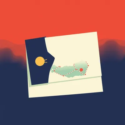
It really is. And for those of you who want to see the maps we are talking about, we will have some links and resources on our website. You can really see how that line cuts right through the heart of the village. It makes the whole thing much more tangible.
Definitely. Head over to myweirdprompts.com to check that out. We have the full archive of all nine hundred forty-six episodes there, including the ones we referenced today. You can search for topics like border security or Middle Eastern geography and find a lot more deep dives.
And hey, if you are enjoying these deep dives, do us a favor and leave a review on your podcast app or on Spotify. We have been doing this for a long time, and it genuinely helps new people find the show. We see the reviews, and we really appreciate the feedback.
Yeah, it means a lot to us. We love building this community of curious minds. And a quick thanks to Daniel, even though he didn't send a prompt today, for keeping the lights on and the house running while we sit here and talk about maps for an hour.
Thanks, Daniel. We will see you at dinner.
Alright, that is it for this episode of My Weird Prompts. I am Corn.
And I am Herman Poppleberry.
We will be back next time with another deep dive into the strange, the technical, and the misunderstood. Until then, keep asking the weird questions.
And keep looking at the maps. There is always more to the story than the lines suggest.
Take care, everyone.
Bye for now.
So, Herman, before we totally wrap up, I was thinking about the tourism thing in Ghajar again. Do you think that is a model that could work elsewhere? I mean, could you turn other border flashpoints into tourist spots?
It is a nice thought, but Ghajar is unique because of the people. The Alawite community there had a very specific reason to choose one side over the other. In most other places, the populations are much more polarized. You cannot really have a boutique cafe in the middle of a minefield if the people on both sides want to kill each other. Ghajar works because the residents actively chose to be part of the Israeli fabric.
That is a fair point. It requires a level of local buy-in that you just do not see in most contested territories. It is almost like a voluntary annexation from the bottom up rather than the top down.
That is exactly what it is. It is sovereignty by consensus at the village level. And in a region where everything is usually decided by high-level diplomacy or military force, that is a very rare and beautiful thing to see.
It really is. It gives you a little bit of hope that even in the most contentious areas, people can find a way to build something positive if they are given the security to do so.
Agreed. Security is the prerequisite for everything else. Without that fence, there are no cafes. It is a hard truth, but it is the truth of the Middle East.
Well said. Alright, now we are actually signing off. Thanks for sticking with us for the extra thoughts.
See you next time.
Goodbye.

")