Welcome back to My Weird Prompts. I am Corn, and today we are looking at a world that feels like it belongs in a spy novel, except it is happening right in front of us on our phone screens every single day. I am joined, as always, by my brother.

Herman Poppleberry, at your service. I have been looking forward to this one. We are diving into a topic that has fundamentally changed how we understand global events in real time. Our housemate Daniel sent us a prompt about this after following some of the recent developments in the Russia Ukraine conflict and the ongoing crisis in Sudan. He was seeing these incredible threads on social media where people were geolocating footage and tracking troop movements before the official news outlets even had a headline.
It is a fascinating phenomenon. Daniel wanted to know about the world of open source intelligence, or OSINT. Who are these people on platforms like X and Telegram? What methods are they using, like high resolution satellite imagery? And how do the big professional agencies like the CIA actually integrate this stuff into their work?
It is a great set of questions because the landscape of intelligence has been flipped on its head over the last decade. It used to be that if you wanted to know what was happening inside a closed country or on a battlefield, you needed a multi billion dollar satellite or a spy on the ground. Today, you just need a person with a lot of patience and a fast internet connection.
So let us start with the who. When we see these accounts on Telegram or X, who are we actually looking at? Is it just hobbyists, or is there more to it?
It is a mix, but the professionalization of the hobbyist has been the big story. You have groups like Bellingcat, of course, which is the gold standard. They have been doing incredible work for years across Europe, the Middle East, and the United States, investigating everything from the downing of flight MH seventeen to domestic issues. But beneath the big names, you have thousands of individual contributors. Some are former military or intelligence analysts who just cannot stop looking at maps. Others are data scientists, architects, or even just people who are incredibly good at playing Geoguessr.
It is interesting that you mention Geoguessr because that skill set of looking at a single frame of video and identifying a specific curb or a power line seems to be the foundation of a lot of this.
Exactly. That is what we call geolocation. The community on Telegram especially has become very decentralized. In the Sudan conflict, which erupted in twenty twenty three and has continued through to twenty twenty six, we saw OSINT groups tracking the movement of the Rapid Support Forces just by looking at the shadows in TikTok videos posted by soldiers. They can look at the angle of a shadow at a specific time of day and cross reference it with architectural features in a city like Khartoum to pinpoint an exact street corner.
That level of detail is mind blowing. But Daniel also asked about the tools. Specifically satellite imagery. I think most people assume that high resolution satellite photos are still the exclusive domain of the government. But that has changed, right?
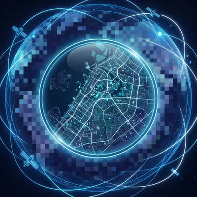
It has changed drastically. There are companies like Maxar and Planet that have completely democratized access to the heavens. Maxar, for instance, has been expanding its WorldView Legion constellation to boost capacity and revisit rates, building on its existing ability to provide thirty centimeter resolution commercial imagery. We are talking about being able to see a specific car on a street and getting a fresh image of that same spot multiple times a day as the constellation grows.
Thirty centimeters. That is enough to see if a hatch is open on a tank or if a specific building has sustained roof damage.
Precisely. And then you have Planet, which operates a huge fleet of smaller satellites. They have their PlanetScope constellation which images almost the entire landmass of the Earth every single day at roughly three to five meter resolution. It is not as sharp as Maxar, but the frequency is the key. If you are an OSINT analyst, you can look at a base in the desert and see exactly when a new row of tents appeared. You can see the tracks in the sand. You can see the change over time.
I remember back in episode two hundred one, when we talked about how hackers find servers, we discussed how much information is just sitting out there waiting to be discovered. This feels like the physical version of that. It is not about breaking into a secret vault. It is about looking at what is already visible but hidden in plain sight.
That is the perfect way to put it. OSINT is about synthesis. It is not just the satellites. It is the combination of satellite imagery with flight tracking data from sites like Flightradar twenty four. You can often see government or transport aircraft flying in and out of regions when their transponders are active. Even when they are not, people on the ground often post photos of unusual planes taking off. When you combine a photo of a plane with a satellite image of an airfield and a Telegram post from a soldier, you suddenly have a complete picture of a secret arms shipment.
But wait, if it is all public, how do the professionals handle it? Daniel asked about the integration of OSINT into professional intelligence agencies. I would imagine the CIA or the Mossad here in Israel have a complicated relationship with these public investigators.
It has been a massive cultural shift for them. For decades, the intelligence community operated on the idea that if it was not secret, it was not valuable. But in the last few years, especially under leaders like CIA Director William Burns, there has been a huge push to prioritize open source data. Director Burns has spoken about how the agency is leaning into OSINT because the sheer volume of data being produced by the world is too large for any secret agency to ignore.
So they are not just looking at their own classified satellites anymore?
They still have those, and those classified birds are incredible. They can do things commercial satellites cannot, like using specific radar frequencies to see through clouds or foliage with even more precision. But the OSINT data provides the context. It provides the breadcrumbs. Some commentators and former officials have claimed that a large share of modern intelligence reporting is derived from or supported by open source information, with figures as high as eighty percent sometimes cited in certain contexts, although those numbers are best understood as rough estimates rather than precise statistics.
That is a staggering number. If most of it is open, what is the rest?
That is the closed source stuff Daniel mentioned. Human intelligence, or HUMINT, which is actual spies talking to people. Signals intelligence, or SIGINT, which is intercepting private communications. And the highly classified satellite data. The magic happens when an analyst takes a public Telegram post about a fuel shortage in a specific province and then uses a classified sensor to confirm that the underground storage tanks at a nearby base are being depleted. The OSINT tells them where to look, and the secret stuff confirms the details.
It sounds like the professional agencies are becoming more like editors of a massive, global, crowdsourced newspaper.
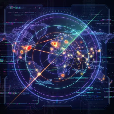
In a way, yes. And they are using AI to do it. While we do not have public names for all their internal tools, we know that agencies are experimenting heavily with large language models to synthesize millions of social media posts, news reports, and satellite metadata. They are building systems that can flag an anomaly—like a sudden spike in mentions of a specific bridge in a conflict zone—and automatically task a satellite to take a high resolution photo of that bridge.
But there has to be a downside to this. If I am a military commander and I know that every person with a smartphone is a potential OSINT sensor, I am going to try to fool them, right?
Absolutely. We are seeing a massive resurgence in the art of deception. In recent conflicts, we have seen reports of militaries using inflatable tanks and wooden decoys to mislead satellite analysts. From a three meter resolution satellite photo, a high quality inflatable tank looks exactly like a real one. It creates what we call the noise problem. If an OSINT analyst on X posts that they see a hundred tanks moving toward the border, but fifty of them are balloons, they have just helped the enemy spread misinformation.
That brings up the issue of verification. How do these people on the internet make sure they are not being played?
The best ones are incredibly rigorous. A common best practice in the OSINT community is to verify at least three things: the location, the time, and the source. They will look at the weather in a video and check historical weather reports for that day. They will look at the position of the sun to verify the time. They will look for landmarks. They do not just take a video at face value. They treat it like a crime scene.
It is almost like a new form of digital literacy. But I worry about the privacy implications. If these tools are powerful enough to track a tank in Sudan, they are powerful enough to track an individual, right?
That is the dark side of this. Facial recognition technology is a huge part of the OSINT toolkit now. With increasingly powerful facial recognition and data broker tools, it is often possible to link a face from a protest video or a combat zone to online profiles and personal information. This raises serious privacy and safety concerns. We have seen cases where soldiers or protesters have been identified and targeted because they were caught on camera for just a few seconds.
It feels like the end of anonymity in public spaces. If you are outside, you are potentially being geolocated by a thousand different eyes.
It really is. And it is not just the government doing the tracking. It is everyone. We are seeing a shift where private companies are hiring OSINT analysts to track their supply chains or to perform due diligence on business partners. It is a tool of accountability, but also a tool of surveillance.
You know, it reminds me of our episode on Zulu time, episode one ninety eight. Everything in OSINT relies on a synchronized, global understanding of when and where things happen. If you do not have that universal clock and coordinate system, none of this works.
Exactly. Everything has to be timestamped and geotagged. But what is really interesting is how this has changed the speed of diplomacy. In the past, if a country did something provocative, it might take days for the information to be verified and for a response to be formulated. Now, the world sees it in minutes. When a hospital was hit or a convoy was blocked in the recent conflicts, the images were on X and Telegram before the smoke had even cleared. This puts immense pressure on governments to react instantly, which can be dangerous if the information hasn't been fully verified yet.
So the speed is a double edged sword. It prevents cover ups, but it also forces rushed decisions.
Right. And it leads to what people call the fog of OSINT. During a breaking news event, you will have dozens of accounts all claiming different things, all using the same blurry satellite photo. It takes hours or days for the actual experts to sift through it and say, no, that is not a missile launcher, that is a grain silo.
I want to go back to the satellite resolution for a second. You mentioned thirty centimeters. For the listeners who are trying to visualize that, what does that actually mean in terms of what you can see?
At thirty centimeters, you can distinguish between different types of vehicles. You can see the difference between an SUV and a sedan. You can see individual rows of crops in a field. You can see the shadows cast by fences. You cannot read a license plate from a commercial satellite image, and you cannot identify a specific person, but you can detect that people are present as just a few pixels. The key is that we are approaching the practical limits of what you can see through the atmosphere without the image becoming too distorted by air turbulence.
So we are reaching the peak of what is possible from space?
For optical imagery, yes, unless you start using much larger telescopes or fly in lower orbits. But the real frontier now is Synthetic Aperture Radar, or SAR. This is what I find truly nerdy and cool. Radar satellites do not need the sun. They send out their own pulses and measure the bounce back. This means they can see through thick clouds, smoke, and even total darkness. During the monsoon season in Southeast Asia or over a cloudy place like Ukraine in the winter, SAR is one of the only reliable ways to see what is happening on the ground.
And is that data available to the public too?
It is. Companies like Umbra and Capella Space sell SAR data. It looks a bit strange to the human eye—more like a grainy black and white x ray than a photo—but for an analyst, it is gold. You can see metal objects reflecting radar waves very clearly. So you can track ships at sea or tanks in a forest even if it is a stormy night.
It is amazing to think that Daniel can just sit in our living room here in Jerusalem and potentially access the same kind of data that a mid level intelligence officer would have had twenty years ago.
It is a total democratization of power. But it also means that the responsibility for truth has shifted. It used to be that we trusted the evening news or the government spokesperson. Now, we have to trust our own ability to evaluate these OSINT sources. We have to look at their track record. Do they admit when they are wrong? Do they show their work? The best OSINT analysts always show the coordinates and the original source files so you can check them yourself.
That transparency seems like the best defense against misinformation. If you can follow the breadcrumbs yourself, you do not have to take their word for it.
Exactly. It is the scientific method applied to the news. You have a hypothesis, you gather the data, you show your evidence, and others try to peer review it.
So, looking ahead to the rest of twenty twenty six, where does this go? Does OSINT just become the default way we consume information?
I think we are going to see even more integration of AI. Right now, it still takes a human to look at a satellite photo and say, hey, that is a new trench. But we are getting to the point where computer vision can scan thousands of square miles of imagery and automatically highlight changes. We are also going to see more tension between the OSINT community and governments. Some countries are already looking at ways to restrict satellite overflights or to jam the frequencies used by commercial imaging satellites.
That sounds like a new kind of arms race. A race between the people who want to see and the people who want to hide.
It is. And as we move into twenty twenty seven, I expect the tools will become even more user friendly. You might not need to be a mapping expert soon. You might just be able to ask an AI, show me all the cargo ships that have left this port in the last forty eight hours, and it will pull the satellite data, the transponder logs, and the social media photos to give you an answer.
That is both incredibly cool and a little bit terrifying. It makes the world feel very small.
It really does. But it also makes it harder for the bad guys to hide. Whether it is human rights abuses in a remote region or a secret nuclear facility, the eyes in the sky are always watching, and the people on the ground are always posting.
Well, I think we have given Daniel a lot to chew on. It is a complex world, but understanding the tools—the satellites, the radar, the geolocation—makes it much easier to navigate the headlines.
Definitely. And for our listeners, the next time you see a breaking news story, take a look at the sources. See if there is an OSINT thread attached to it. It is a great way to see the raw data before it gets processed into a narrative.
Before we wrap up, I want to say that if you are enjoying these deep dives, we would really appreciate it if you could leave a review on your podcast app or on Spotify. It genuinely helps other curious people find the show.
Yeah, it makes a big difference for us. This has been My Weird Prompts. You can find us on Spotify and at our website, myweirdprompts.com.
Thanks for listening, and thanks to Daniel for the great prompt. We will see you next time.
Stay curious, everyone. Bye for now.
")