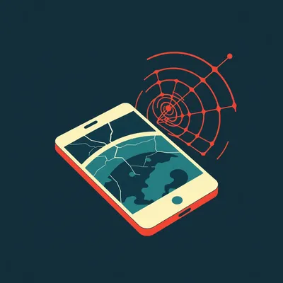
Imagine you are looking at a photograph. There is no metadata, no location tags, and no obvious landmarks like the Eiffel Tower or the Statue of Liberty in the background. It is just a dusty road, some scrubby bushes, and a few power lines stretching into the distance. To most people, that image is a dead end. It is a digital ghost. But to an open source intelligence analyst, that photo is screaming its location at you. You just have to know how to listen to the physical frequency it is broadcasting.

Herman Poppleberry here, and Corn, you have hit on the exact frustration of the modern OSINT era. We live in a world where everyone wants a magic button. People want to drop a file into a website, wait three seconds, and have a little red pin drop on a map with ninety nine percent accuracy. But as our housemate Daniel pointed out in the prompt he sent over this morning, relying purely on automated tools is a dangerous trap. If the metadata is stripped, which it almost always is on social media platforms, or worse, if it is spoofed to lead you astray, most rookies are completely lost. They stare at the screen waiting for the software to tell them the answer, instead of looking at the image to find the answer.
It is the tool trap. We have talked about this in different contexts before, but in geolocation, it is especially high stakes. If you do not understand the physical foundations of the world, you are just guessing. You are a passenger in your own investigation. Today, we are going to strip away the software and talk about the analog skills of reading a landscape. We are going to look at how the environment, the infrastructure, and even the way the sun hits a brick wall can tell you exactly where on this planet a photo was taken. This is about moving from being a tool user to being a landscape reader.
This is really the bedrock of open source intelligence. Even when we talked about high tech stuff back in episode six hundred twenty-nine, where we looked at how artificial intelligence is starting to recognize patterns in satellite imagery, the human eye is still the gold standard for nuance. AI can tell you that a patch of green is a forest, but it might not realize that the specific species of pine only grows on the northern slopes of the Carpathian Mountains. I am excited to dig into this because it turns every image into a puzzle that you can actually solve with logic and observation rather than just a fast internet connection and a subscription to a proprietary database.
And before we dive deep, I want to reference something we touched on in episode one thousand three, which was all about the sky. We called it the sky is a snitch, and today we are going to expand that to the ground, the trees, and the buildings. We are moving from the digital layer down to the physical layer. We are treating the sky not as a backdrop, but as a data point. So, Herman, where do we start when we have nothing but a horizon and some dirt? How do we begin the pre-flight check before we even think about opening Google Earth?
You start with the environment. Most people treat the background of a photo as just scenery, but it is actually a biological and geological signature. Let us talk about vegetation. If you see a tree, you are not just looking at a plant. You are looking at a climate proxy. Plants are the ultimate stationary sensors. They have very specific requirements for temperature, soil acidity, and rainfall. You are not going to find a Baobab tree in the middle of a Siberian forest, and you are not going to find a Silver Birch in the middle of the Sahara.
Right, because plants have spent millions of years adapting to very narrow niches. Analysts use something called the Koppen climate classification system. It divides the world into five main climate groups based on vegetation. If you can identify the species of a tree or even the type of grass, you have immediately narrowed down your search area from the entire planet to maybe a few specific biomes. For example, if you see a Saguaro cactus, you are not just in a desert; you are specifically in the Sonoran Desert, which covers parts of Arizona, California, and Northwestern Mexico. That one plant just eliminated ninety nine point nine percent of the Earth's surface.
But here is the challenge I always think about, Herman. What about ornamental plants? People plant palm trees in London and cacti in indoor malls in Dubai. How do you distinguish between what is native and what is just landscaping? That is where the rookie gets tripped up. They see a palm tree and think they are in the tropics, but they are actually in a chilly courtyard in Vancouver.
That is a great question, and it is where the "transition zone" concept comes in. You have to look for the transitions. Native vegetation usually follows a pattern of density and variety that looks natural. It follows the terrain. If you see a single palm tree surrounded by oaks and maples, that is a human choice. It tells you less about the climate and more about the wealth or the aesthetic of the property owner. But if you look at the horizon and see a consistent canopy of a specific type of pine, like the Aleppo pine we see around here in Jerusalem, that tells you that you are likely in a Mediterranean climate zone. You look for the "wild" plants, the weeds in the cracks of the sidewalk, or the unmanaged scrub on a hillside. Those are the honest witnesses.
And it is not just the trees. It is the agricultural patterns too. If you see terraced farming on a hillside, that narrows your search to specific regions in Southeast Asia, parts of the Mediterranean, or the Andes. The way humans interact with the land is often dictated by the physical constraints of the soil and the slope. Even the color of the soil is a clue. Red clay suggests high iron content, common in places like Georgia in the United States or parts of Brazil and Australia. Dark, black soil, or Chernozem, points you toward the "breadbasket" regions like Ukraine or the Canadian prairies.
Now, let us move from the ground to the horizon. In episode one thousand three, we discussed the "horizon blur," but the physical reality behind it is that every mountain range has a unique silhouette. This is one of the most powerful analog techniques because it is almost impossible to spoof. If you can see a mountain range in the distance, you can use digital elevation models, or D E M s, to match that silhouette.
I love the horizon matching technique because it feels like a fingerprint. Even if the photo is low resolution, the jagged edge of a mountain range against the sky is very hard to fake. You can take a thirty meter resolution digital elevation model and basically rotate a virtual camera until the peaks align with your photo. Organizations like Bellingcat have used this to verify the locations of training camps or conflict zones where there are zero man-made landmarks. If you have three peaks in a specific configuration, there is often only one place on earth where they look exactly like that from a specific angle.
There was a famous case study where an analyst used the specific angle of a shadow on a building facade to narrow down a location to a fifty kilometer radius. This brings us to solar geometry. It sounds intimidating, but it is actually just high school trigonometry applied to the real world. The sun is the ultimate clock and compass. If you have a clear shadow in a photo, you have a wealth of data. First, the direction of the shadow tells you the cardinal directions, provided you know roughly what time of day it is. Or, if you know the location, the shadow tells you the time.
It is basic physics, but it is a physical foundation that cannot be scrubbed from the image. If you know the date the photo was taken, and you measure the ratio of the shadow length to the object height, you can calculate the solar elevation angle. Once you have that angle and the date, you can narrow the latitude down to a specific band on the earth. If the shadow is very short at noon, you are near the tropics. If it is long even at midday, you are far north or far south.
There are limitations, though. In high-latitude regions during the winter, the sun stays so low on the horizon that shadows are perpetually long, which can make precise latitude estimation a bit more difficult. And you have to be careful with the "golden hour." The golden hour looks different at the equator than it does in Northern Europe. At the equator, the sun drops almost vertically, so the transition from day to night is very fast. In Northern Europe, the sun sets at a shallow angle, leading to a much longer, more drawn-out twilight. The quality of the light, the way the atmosphere scatters it—what we call Rayleigh scattering—tells you about the moisture and dust in the air, which are further clues to the environment.
Now, let us bring our eyes down from the sun and the mountains and look at the things humans have built. This is where infrastructure forensics comes in. This is one of my favorite parts of the process because it is all about the tiny details that we usually ignore in our daily lives. Like road markings. I have noticed that people often assume all roads look the same, but the conventions for paint are incredibly regional.
Oh, they are a gold mine. In the United States, for example, you have yellow lines in the center and white lines on the edges. In many parts of Europe, all the lines are white. But then you get into the specifics. In the United Kingdom, they use those zigzag lines near pedestrian crossings. In some Nordic countries, the lines are yellow to stay visible against the snow. And it is not just the color. It is the style of the dashed lines. The length of the dash versus the length of the gap is often standardized by national transit authorities. If you see a specific ratio of dash to gap, you can sometimes identify the country within seconds.
And do not forget the utility poles. This is a very nerdy subculture in the OSINT community. The design of a power pole, the shape of the insulators, and the way the transformers are mounted are often unique to specific utility companies or national grids. I have seen people identify a specific province in Thailand just by the shape of the concrete utility poles. Some are square, some are round, and some have a very specific hole pattern for climbing. It is a physical fingerprint of the local engineering standards.
It really is. And this leads us into architectural fingerprinting. Architecture is not just about style; it is about materials and climate adaptation. If you look at the pitch of a roof, it tells you something about the local weather. A very steep pitch is designed to shed heavy snow, which you see in the Alps or Scandinavia. A flat roof is more common in arid climates like where we are here in Jerusalem.
And the materials themselves are huge. The color of the brick, the type of stone, even the style of the window frames. In many parts of the world, building materials are sourced locally because it is cheaper. So the specific shade of red in a brick wall might only be found within fifty miles of a particular clay quarry. Think about Soviet-era architecture. Those prefabricated concrete panels, the Khrushchevka style buildings. They have a very specific look, but even within that, there are variations between what you see in Ukraine versus what you see in Kazakhstan. The balcony styles, the way the air conditioning units are mounted, the presence of external gas pipes.
The gas pipes are a classic one. In many post-Soviet countries, the gas lines run along the outside of the buildings or even over the streets on yellow supports. If you see that, you have instantly narrowed your search to a very specific part of the world. This is what we mean by physical foundations. You are building a mental library of what the world actually looks like. Instead of searching for the location, you are excluding the impossible.
This is the heart of the Bellingcat methodology. They talk about iterative hypothesis testing. You do not start by asking "where is this?" You start by asking "where can this not be?" It is a process of elimination. If I see a car driving on the left side of the road, I have just eliminated about seventy five percent of the world. If I then see a specific type of eucalyptus tree, I am looking at Australia, South Africa, or maybe parts of California or the Mediterranean. If I then see a specific style of blue license plate, I might be down to just a few states or provinces.
It is about stacking these physical cues until only one possibility remains. And the beauty of this is that it works even on low quality images. You do not need to read the street sign if you can read the environment. I want to talk a little bit more about that Bellingcat approach because they have really formalized this for the digital age. They emphasize that eighty percent of the work happens before you ever touch a map. It is all about the observation phase.
Right. They teach analysts to do a thorough scan of the image and list every single physical attribute. They call it a feature list. You write down the road texture, the vegetation type, the sun angle, the building materials, the clothing of the people, the language on the signs, and even the types of trash on the ground.
The trash! That is such a good point. Different countries have different brands of soda, different styles of cigarette packs, and different colors of garbage cans. Even the way a curb is painted, like the red and white curbs we have here in Israel to indicate no parking, that is a local convention that tells a story. In the United Kingdom, they use yellow lines on the curb to indicate loading restrictions. In the United States, fire hydrants are often color-coded to indicate the water flow rate. These are all data points.
And once you have that list, then you start your search. But you are not searching for the location; you are searching for the intersection of those features. You are looking for a place where a steep roof, a red brick wall, and a yellow gas pipe all exist in the same climate zone. This is much more efficient than just wandering around Google Street View hoping to see something familiar.
So, let us talk about how someone can actually practice this. If you are a listener and you want to get better at this analog geolocation, where do you start? Because it feels like you need to be a botanist, an architect, and a civil engineer all at once.
It does feel that way, but it is really about developing a habit of looking. I always recommend people play GeoGuessr, but with a twist. Most people play it by looking for a URL on a billboard or a phone number on a truck. That is the easy way. If you want to build your physical foundations, you should play it by disabling the ability to move or zoom. You have to geolocate based purely on the static image in front of you.
That is a great exercise. It forces you to look at the dirt. Is it red clay? Is it sandy? Is it dark loam? It forces you to look at the shadows. It forces you to look at the species of the trees. You start to realize that the world has a lot of texture that you normally just gloss over. Another great tip is to build your own reference library. When you are traveling, or even just walking around your own city, take notes. What do the manhole covers look like? Are they made by a specific company like Wavin or Saint-Gobain? What color are the fire hydrants? How are the street signs mounted? Are they on their own poles, or are they attached to the sides of buildings?
I have actually started doing that. I noticed that in some cities, the street names are carved directly into the corner of the stone buildings. In others, they are blue enamel plates. In others, they are green reflective metal. These little regional standards are the breadcrumbs of geolocation. And I think we should talk about the three-pass method for analyzing an image. This is a good framework for our listeners to take away.
Okay, let us break it down. What is the first pass?
Pass one is the environmental pass. This is where you look at everything that is not man-made. The sky, the mountains, the vegetation, the soil, and the sun. You are trying to determine the ecoregion and the approximate latitude. You are setting the stage. You are asking: "What part of the world has this climate and this geology?"
Got it. So that is where you use your knowledge of hardiness zones and solar angles. What is pass two?
Pass two is the infrastructure pass. Now you look at the roads, the power lines, the signs, and the vehicles. You are looking for national or regional standards. This is where you narrow it down from a climate zone to a specific country or province. You are looking for the "rules" of the human-built environment.
And pass three?
Pass three is the architectural and cultural pass. You look at the buildings, the materials, the local brands, the fashion, and the specific urban layout. This is where you get down to the city or neighborhood level. Only after you have done these three passes do you open up your digital tools and start looking for a specific match.
I like that because it prevents you from getting lost in the weeds too early. If you start searching for a specific building before you even know what country you are in, you are going to waste hours. But if you know you are in a temperate climate, in a country that drives on the right, with a specific style of concrete power pole, your search area becomes manageable. It turns a needle-in-a-haystack problem into a needle-in-a-small-box problem.
It is about efficiency. The best analysts are not the ones with the most tools; they are the ones who can narrow the search area the fastest using their brain. Now, Corn, I want to touch on something a bit more advanced. As we move further into the age of deepfakes and artificial intelligence generated imagery, how do these physical foundations help us verify if an image is even real?
Oh, this is where it gets really interesting. Artificial intelligence is getting very good at making things look plausible, but it often struggles with the logic of physical systems. For example, an AI might generate a beautiful landscape, but the shadows might not match the position of the sun. Or it might place a species of tree that would never grow in that specific soil type. I have seen AI images where the power lines do not actually connect to anything, or the road markings follow a pattern that makes no sense for traffic flow.
If you understand the physical foundations of how a city is built, you can spot those inconsistencies immediately. A road that is six lanes wide but has no drainage system is a red flag. A building with a massive window facing the direct midday sun in a desert climate without any shading is a red flag. The physical world has a logic that is dictated by survival and efficiency. AI often just follows a logic of aesthetics. It knows what a "city" looks like, but it does not always know how a city "works."
So, being a good OSINT analyst is actually a form of defense against disinformation. By understanding how the world is physically put together, you become much harder to fool. You are not just looking at pixels; you are looking at the physics behind the pixels.
It is about being grounded in reality. And I think that is a good place to start wrapping this up. The tools are great, and we use them every day, but the tool is only as good as the person wielding it. If you do not have that physical intuition, you are just a passenger. The best tool is the one between your ears.
I love that. And I think this approach really empowers people. You do not need a massive server farm to start doing this. You just need a curious mind and a willingness to look at the details. You can practice this every time you step out of your front door. Look at the curb. Look at the trees. Look at the way the light hits the buildings at four in the afternoon.
Well, Corn, I think we have given people a lot to think about. From the way the sun hits a wall to the color of the dirt under your feet, the world is full of clues. You just have to be willing to see them. Thanks for the prompt, Daniel, it was a fun one to dig into. It is always good to get back to the foundations.
It really is. For everyone listening, if you want to practice this, go to our website, myweirdprompts dot com. We have links to some of the past episodes we mentioned, like episode one thousand three about the horizon blur and episode six hundred twenty-nine about artificial intelligence geolocation. You can also find our R S S feed there if you want to make sure you never miss an episode.
And do not forget the Telegram channel. Just search for My Weird Prompts on Telegram. It is the fastest way to get notified when we drop a new one. We really appreciate the community that has grown around this show.
We really do. And hey, if you have been enjoying these deep dives, do us a favor and leave a review on your podcast app or on Spotify. It genuinely helps other people find the show and helps us keep doing this. A quick rating makes a huge difference.
Alright, I think that is it for today. This has been My Weird Prompts. Until next time, keep your eyes on the horizon.
And your feet on the ground. Thanks for listening.

")