You know, Herman, I was walking through the living room this morning and I almost tripped over Daniel's new robot vacuum. It was doing that little dance where it spins in circles, and then—I kid you not—it extended these little mechanical legs and hopped right over the rug edge. I realized it was literally seeing the room in a way I couldn't. It is wild to think that this little plastic disc has more sophisticated spatial awareness than some of the most advanced technology from just a decade ago.

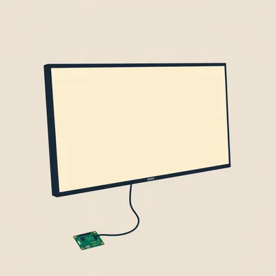
It really is incredible. That is the new Roborock S8 Pro Ultra Daniel just got. And for those just joining us, I am Herman Poppleberry. And you are right, Corn, that little dance the vacuum does is actually it firing out thousands of laser pulses every second. Daniel sent us a fascinating audio prompt about this today. He has been seeing how generative artificial intelligence is taking over architecture and interior design, but he is particularly curious about the hardware side of things. Specifically, LiDAR.
Right, and he mentioned how his friend Hannah, who is an architect, is seeing this trend everywhere. It has moved from these massive, multi-thousand-dollar rigs to something we just carry in our pockets or let roam around our floors. It is the democratization of three-dimensional scanning.
Exactly. Daniel wanted us to dig into how we are capturing the digital world. And I love this topic because it bridges that gap between the physical reality we live in and the digital models we are increasingly using to design and interact with that reality.
So, let us start with the basics for a second, because I think people hear the word LiDAR and they might have a vague idea it involves lasers, but how does it actually work compared to, say, a regular camera or even sonar?
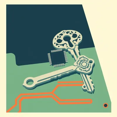
That is a great place to start. LiDAR stands for Light Detection and Ranging. Think of it like a bat using echolocation, but instead of sound waves, it uses light. Specifically, it uses near-infrared light. The device sends out a pulse, it hits an object, bounces back, and the sensor measures exactly how long that trip took. Since we know the speed of light is a constant, we can calculate the distance with incredible precision.
Okay, so it is essentially measuring the time of flight for these light particles. But a camera just takes a flat picture. How does LiDAR turn those timing measurements into a three-dimensional map?
Well, it is all about the point cloud. Imagine firing one laser. You get one distance. Now imagine firing millions of them in every direction. Each point where a laser hits an object becomes a coordinate in a three-dimensional space. When you stitch all those millions of points together, you get what we call a point cloud. It looks like a ghostly, translucent version of the room. It does not necessarily have color or texture at first, but it has perfect geometry.
That is the distinction that I think is important. Most people think of capturing a space as taking a photo or a video. But LiDAR is capturing the bones of the space. It is capturing the math of the room.
Spot on. And that is why it is so vital for architects like Hannah. If you take a photo of a room, you cannot easily tell if the wall is exactly twelve feet long or if the ceiling is slightly sloped. But with a LiDAR scan, you have those measurements down to the centimeter, sometimes even the millimeter. We actually touched on the history of these kinds of technological shifts back in episode thirteen, when we talked about how artificial intelligence is not just an overnight success but a long tail of hardware and software evolving together. LiDAR is a huge part of that hardware evolution.
It is interesting because for a long time, if you wanted a LiDAR scan of a building, you had to hire a specialized firm with a tripod-mounted scanner that cost fifty thousand dollars. But Daniel pointed out that now, it is in the iPhone Pro models. Why did Apple decide to put a survey-grade sensor in a consumer phone? It seems like overkill for just taking better selfies.
You would be surprised! It actually started with the iPhone 12 Pro back in 2020. Apple's primary motivation was to solve two main problems. The first was low-light photography. Cameras struggle to focus in the dark because they rely on contrast. LiDAR does not care if it is dark. It sends its own light out. So, it can find the subject and focus instantly, even in a pitch-black room.
Oh, that makes sense. It is like a rangefinder for the autofocus system.
Exactly. And the second reason was Augmented Reality, or AR. For AR to look convincing, the phone needs to understand occlusion. That is a fancy way of saying it needs to know that if a virtual cat walks behind your sofa, the sofa should hide the cat. Without LiDAR, phones have to guess where the floor and furniture are using just the camera feed, which is laggy and often wrong. LiDAR gives the phone an instant, accurate map of the environment so the virtual objects can interact with the real world perfectly.
I have noticed that when I use those room-scanning apps on my phone, it feels almost magical how it can identify where a wall ends and a window begins. But I wonder about the accuracy. If Hannah is using an iPhone scan for an architectural project, can she really trust it?
It depends on the scale. For a quick interior layout or a conceptual design, absolutely. It is remarkably accurate for a consumer device. However, it is not going to replace a professional-grade terrestrial laser scanner for, say, checking the structural integrity of a bridge. The iPhone sensor has a range of about five meters, so about sixteen feet. It is designed for rooms, not skyscrapers. But the fact that you can walk through a house, wave your phone around for five minutes, and come out with a three-dimensional mesh that is within one or two percent of reality? That is a game changer for the workflow.
And that leads right into what Daniel mentioned about generative AI. We talked in episode forty-seven about how AI is being used to transform sketches into full architectural renders. But the missing link for a long time was getting the real world into the AI. Now, we are seeing the rise of things like Gaussian Splatting.
Oh, I am glad you brought that up! Gaussian Splatting is the visual skin to LiDAR's bones. While LiDAR captures the precise math of the room, Gaussian Splatting uses the camera to turn those points into photorealistic, three-dimensional scenes. If you feed a LiDAR scan into a generative AI model today, you can basically say, Here is my actual living room, now show me what it would look like in a mid-century modern style with a vaulted ceiling. The AI understands the volume of the room because of the LiDAR, so the furniture it generates actually fits.
That is exactly what Daniel was talking about with Scan to B-I-M. B-I-M stands for Building Information Modeling. Traditionally, a junior architect would have to spend days manually drawing a floor plan based on tape measurements. Now, you scan the room, the software uses AI to recognize that this cluster of points is a chair and this flat plane is a wall, and it automatically generates the CAD model. It is about removing the grunt work of data entry.
And it is not just for architects. Look at that Roborock S8 Pro Ultra we mentioned earlier. It uses LiDAR for something called S-L-A-M, or Simultaneous Localization and Mapping. That vacuum is basically a self-driving car for your living room. It has up to 10,000 pascals of suction power, but its real secret sauce is that spinning turret on top. It solves the chicken-and-egg problem: it builds a map to know where it is, and it needs to know where it is to build the map.
I have seen the maps my vacuum generates in its app, and they are surprisingly detailed. You can see the individual legs of the dining room chairs. But here is a question that I think might bother some people: privacy. If my vacuum is creating a high-precision three-dimensional map of my home, where is that data going?
That is the big second-order effect we always talk about. Most of these companies claim the mapping data stays local, but a three-dimensional map of your home is incredibly valuable. It tells a company exactly how large your house is, what kind of furniture you have, and even your lifestyle habits. We are moving toward a world of Digital Twins, where every physical space has a digital copy. If that copy is stored in the cloud, it could be used to train AI models on how humans live, or even for targeted advertising. Oh, we see you have a very old sofa, here is an ad for a new one.
It is something we touched on in episode one hundred and fifty-three when we discussed designing the voice-first workspace for Daniel. The more sensors we bring into the home to make things smart, the more we are essentially living inside a data collection rig.
Right. But on the flip side, the benefits for accessibility are massive. Imagine a person who is visually impaired having a wearable device with LiDAR—or even using the latest spatial computing headsets—that can give them haptic feedback about the environment. There is a chair three feet to your left, or the doorway is directly ahead. Because LiDAR does not rely on light, it works perfectly in a pitch-black hallway. It is giving sight to machines and, by extension, helping humans navigate in ways they could not before.
That is a really powerful application. Now, I want to go back to something Daniel said about professional LiDAR being expensive. Why is there such a massive price gap? You can buy an iPhone for a thousand dollars that has LiDAR, but a professional survey drone might cost twenty thousand. What is the difference in the actual light being used?
There are a few factors. One is density and accuracy. A professional scanner might fire a million pulses a second with a precision of two millimeters at a distance of a hundred meters. The iPhone is firing far fewer pulses and its accuracy degrades quickly after a few meters. Another factor is multi-return capability. Professional LiDAR can actually see through trees.
Wait, how does light see through a tree?
It is called multi-return. When a laser pulse hits a tree, some of the light bounces off the leaves, but some of it travels through the gaps and hits the branches, and some of it goes all the way to the ground. A professional sensor can record all of those different returns from a single pulse. This allows archaeologists to fly a drone over a dense jungle and digitally strip away the vegetation to see the ruins of a lost city on the forest floor. The iPhone sensor cannot do that. It just sees the first thing it hits.
That is incredible. I have read about that being used to find Mayan cities that were completely hidden for centuries. So, we are literally using light to peel back the layers of time.
Exactly! It is archaeology at the speed of light. And it is also how self-driving cars work. They use high-end LiDAR to create a real-time, three-dimensional view of the road, identifying pedestrians and obstacles even in rain or fog where cameras might struggle. It is all the same basic principle, just scaled up in terms of power and processing.
So, if we look at the trend Daniel is pointing out, we are seeing this convergence. We have the hardware becoming cheap and ubiquitous in our phones and vacuums. We have the software, specifically generative AI, becoming capable of understanding that spatial data. What does this look like in five years? Are we all going to have digital twins of our entire lives?
I think so. I think the photo album of the future is going to be a series of spatial captures. Imagine being able to walk through your childhood home exactly as it was on your tenth birthday because someone did a quick LiDAR scan of the room. We are moving from capturing a moment to capturing a space.
That is actually a bit emotional when you think about it. It is a form of digital preservation. But it also changes how we interact with the world. If I am shopping for a new rug, I will not be guessing if it fits. My phone will already have a perfect model of my room, and I will just drop the rug into the space with perfect physical accuracy.
And for people like Daniel and Hannah, the design process becomes much more collaborative. You can scan a site, send that three-dimensional file to a client across the world, and both of you can stand in the virtual version of that room using a headset to discuss changes. It removes the abstraction of two-dimensional blueprints.
You know, it is funny. We have spent all this time talking about how advanced this is, but in a way, it is making technology more human. We perceive the world in three dimensions, but for the last hundred years, our digital interaction has been trapped in two-dimensional screens. LiDAR is the bridge that finally lets the computers see the world the way we do.
That is a perfect way to put it. It is the end of the flat era. We are finally giving our digital tools a sense of depth. And honestly, I think we are just scratching the surface. We have not even talked about how this will integrate with the next generation of smart glasses. Imagine walking through a city and having your glasses use LiDAR to highlight the history of the buildings around you.
It is the World-Scale A-R concept. But it all starts with these little sensors. It is a good reminder that while we focus a lot on the brain of AI, the senses of the machine are just as important. Without LiDAR, the AI is basically a brain in a jar. With it, the AI has eyes that can perceive the physical world.
Exactly. And speaking of perceiving the world, I think it is time we wrap this one up before I start geeking out about the physics of photon counting. But before we go, I want to say thanks to Daniel for sending this in. It is a great example of how a simple observation about a vacuum cleaner can lead to a discussion about the future of human civilization.
Absolutely. And if you are listening and you have been enjoying these deep dives into the weird and wonderful world of tech and design, we would love it if you could leave us a review on your favorite podcast app. It really does help other curious minds find the show.
Yeah, it makes a huge difference. You can find all our past episodes, including the ones we mentioned today about AI history and design, over at myweirdprompts.com. We have a full archive there, and you can even send us your own prompts through the contact form if you have something you want us to explore.
We are always looking for new rabbit holes to go down. This has been My Weird Prompts. I am Corn.
And I am Herman Poppleberry.
Thanks for listening, and we will catch you in the next one.
See you then!
You know, Herman, I just thought of something. If we have a digital twin of the house, does that mean I can virtually clean my room and call it a day?
Nice try, Corn. But until we get those robot arms we talked about in the automation episode, the physical dust is still your responsibility.
Worth a shot. Alright, everyone, thanks for tuning in. Goodbye!
Take care!
My Weird Prompts is a collaboration between us and our housemate Daniel.
Check us out on Spotify or at myweirdprompts.com.
Catch you later!
Cheers!
Alright, let us go empty that vacuum. If only I had LiDAR for my keys, I would never be late again.
Now that is a product idea. We will talk about it in episode four hundred and sixty.
Deal. Bye!
Bye!
")